OverviewClick on any image to enlarge it |
CLICK BELOW TO SEE WORKING UNIT
|
|
|
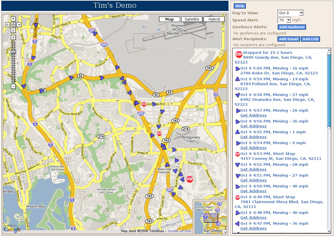
Main Map Page
This is where you can see all of your GPS tracking data including the location, speed and direction of the vehicle.
All of your vehicle locations have been marked on the map in 6 minute intervals.
|
|
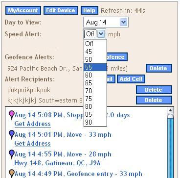
Set Speed Limit
Vehiclepath lets you control how fast you allow your drivers to drive.
By choosing a speed from the field you establish the maximum speed
allowed to be driven before an alert is sent to you letting you know
a violation is taking place.
|
|
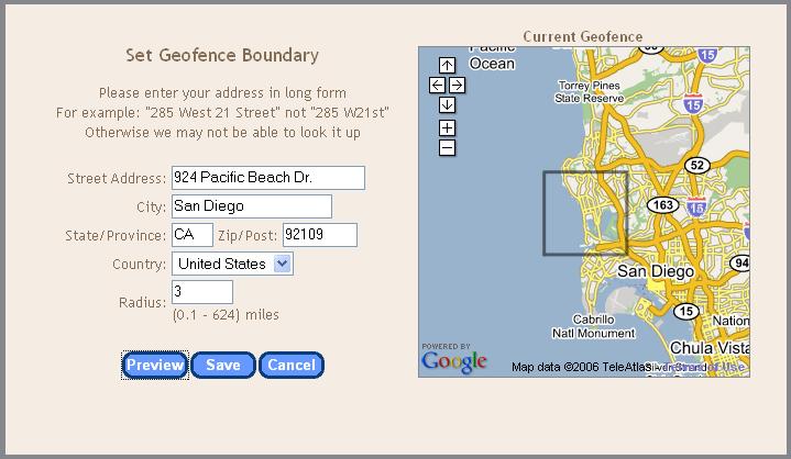
Set Geofence
Vehiclepath GPS fleet tracking system allows you to determine how far you allow your
vehicle/asset to travel. You are able to establish a
starting point such as a home or business, then set the
furthest distance your vehicle/asset can go. You can set it from
0.02 to 624 miles. Your location maps will show the perimeter you
have set with a black line. Up to three GPS enforced geofences
are supported per vehicle.
|
|
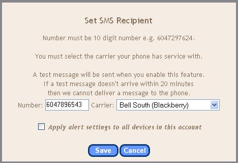
Set Alerts
In order to know when your Vehiclepath GPS fleet tracking system
records a speed or geofence violation, a message is sent to your
email or cell phone or both. You can specify up to three recipients.
|
Click here to preview the Vehiclepath beta site. |
